
The Flood Flush
Stream flows, drawdowns, and algal blooms on repeat in the Texas Hill Country

By Ben Christensen, Old Republic Journal
Tuesday I tried to fish one of the road crossings over the Pedernales River not far from Fredericksburg.
I haven’t fished this particular spot in a while, relying on a spot rich with Guadalupe bass, Rio Grande Cichlids and carp that’s my Number 1 honey hole. This is maybe my number four spot, but it’s pretty.
Well, when I went, it was anything but pretty. The sycamores and cypresses on the bank were pretty as ever—dressed in the deep, dark summer greens of mid-summer. But the water was algal snot. I pulled up algae on my fly with every cast, so I kept working farther downstream, looking for clearer water (I hadn’t waded upstream because the water was completely matted with mucous-colored algae there.) The banks were a lot brushier than they had been.
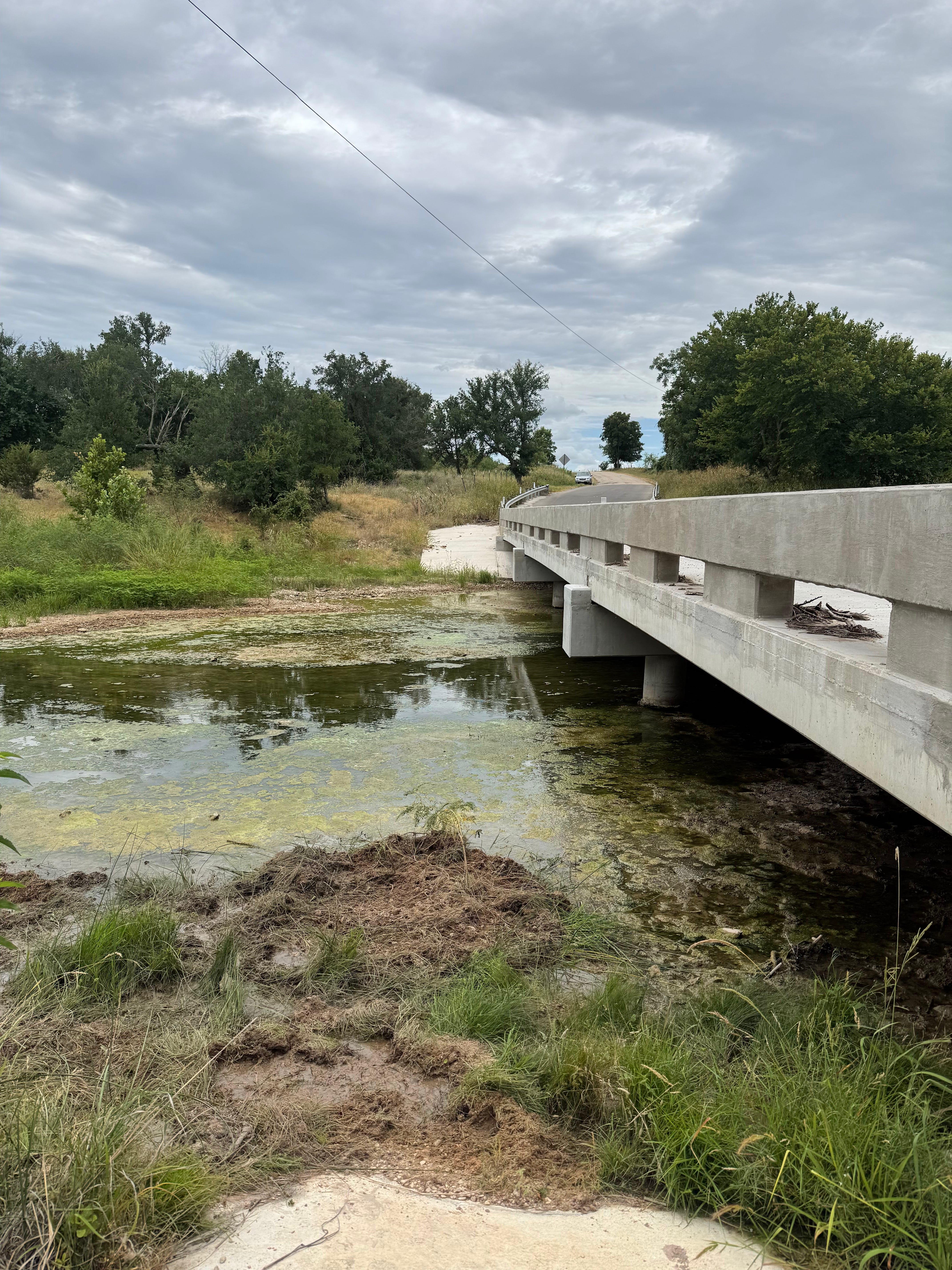
Mid-July Pedernales River crossing, earlier this week. Photo by Ben Christensen.
The June rains that fell on the Pedernales had provided a thorough flush that gouged the shallow wading flats I had previously relied on to keep my car key keyless entry fob dry. When those key fobs get wet, they play hell on trying to get into your car and the whole alarm thing.
I was sternum-deep in this Rambo jungle water when I gave up. I needed my kayak anyway, and a few blue cats and carp and Rios weren’t about to play with my gunked-up fly.
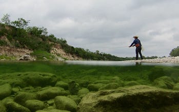
I headed to McDougall’s Crossing, which is my favorite limestone sight-casting-for-Guads spot that features shallow gin-clear water over a ridged, slabby limestone bottom. The bass show as electric pixel-tattooed torpedoes of yellow and green and the sight casting is sublime there. It was late afternoon and I decided then to write a technical, mid-summer piece for my Fishing the Texas Hill Country in the Middle of Damn Summer series about how to work the sun and glare that will have you sight casting like a boss to the fish.
The Myth of the “Bad (For Fish) Flood”
But then the July flood anomaly happened. The excessive rainfall we have seen in the western Hill Country, specifically the Nueces and San Antonio River Basins, but synoptic in its regionality, is an anomaly because we had more than four inches in June. That marks two purgative floods for the Hill Country in as many months. That is indeed an anomaly, and I had one reader reach out and tell me he immediately thought of last week’s Old Republic Journal piece on El Niño and its typical impacts on Texas.
These back-to-back deluges provide an opportune time to explore aquifer recharge and groundwater drawdown patterns that affect summer stream flows.
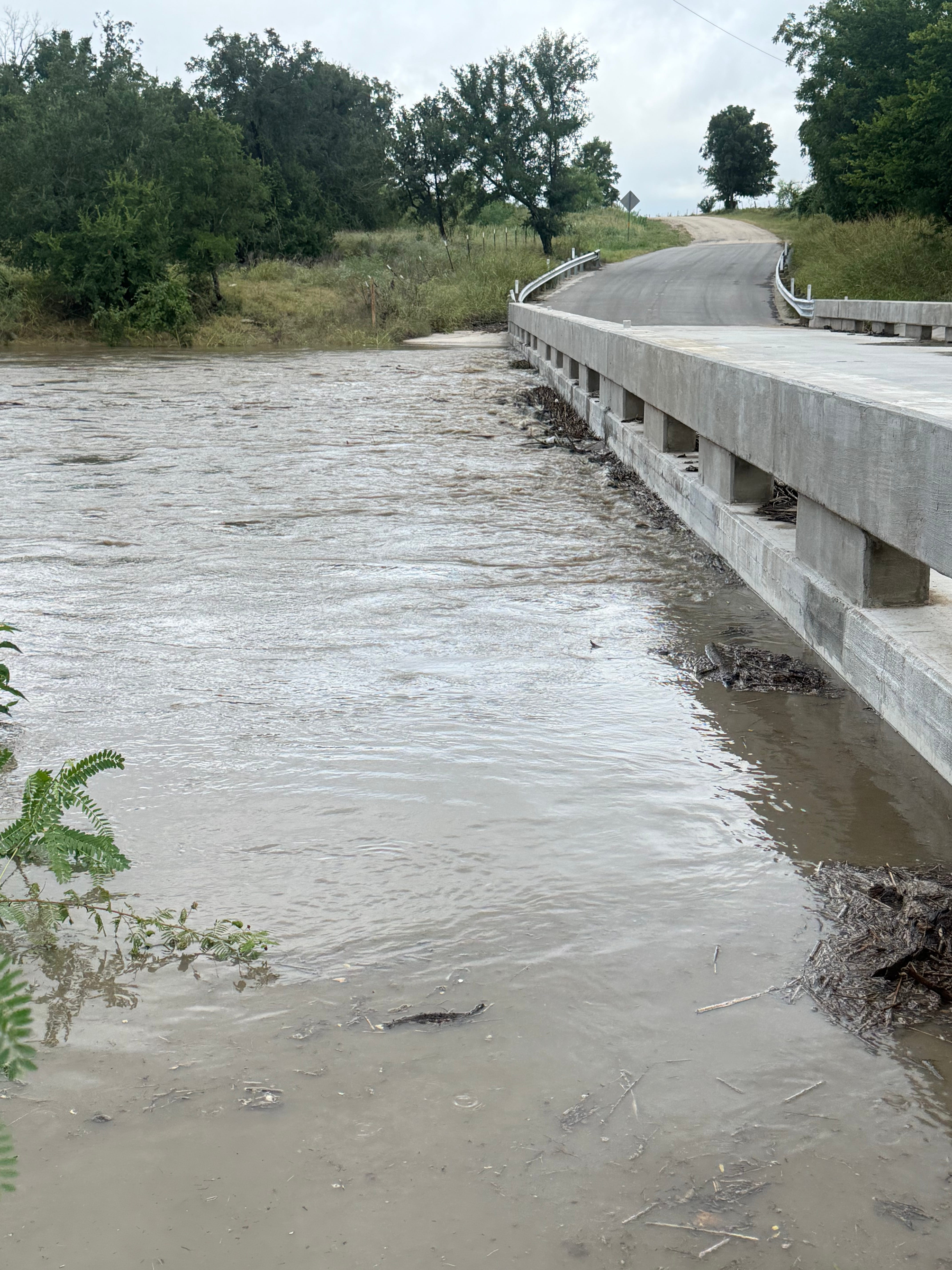
Same Pedernales River crossing, Wednesday. Photo by Ben Christensen.
The reality of floods: Outside of loss of human life, and (to a far lesser degree) property, floods are wonderful for the rivers themselves. I’ve heard talk about Hill Country floods being bad for the wonderful warmwater cornucopia of the region’s fish: largemouth and smallmouth bass, Rios, carp, gar, and the panfish. But that’s bunk. Not only my decade-plus experience of actively fishing the Hill Country speaks to this: Texas Parks and Wildlife Department (TPWD) fish population survey conducted in 2025 after devastating July floods showed fish populations were robust only a couple of weeks afterward.
Floods are vital to waterway health. The slippery algal slime on low, exposed rocks that are dangerous slip hazards for anglers get scoured by limestone and granite sands, reducing hazardous build-up. The algal snot gets flushed completely, and fly-catching weeds and rattelbrush get scoured away and pushed as flood debris to the higher banks up-gradient. With it the pulse of water, too, the build-up of anaerobic phosphorous concentrations from winery fertigation and hay fertilizers is carried away and diluted into the lakes and reservoirs downstream, so that people can shower and brush their teeth and have drinking water. You know, like get cleaned up to go on a weekend winery date to Fredericksburg.
Groundwater Drawdowns and Algal Blooms
The algae builds up because of synthetic fertilizers used on the numerous vineyards around Fredericksburg, and large hay operations using synthetic fertilizers. I’m not going to editorialize on this right now. But a gazillion vineyards flanking the Pedernales River as it snakes along Highway 290 between Johnson City and Fredericksburg get bragging rights on the mats of algae.
They also own a piece of a new, troubling drawdown pattern in groundwater. After the 2015 flood, the Pedernales River took several months to go back down to single-digit flows. Now, the river goes back to 1.4 CFS in a month’s time. This isn’t due only to the wineries and venues drilling multiple shallow wells along the banks of the Pedernales River, which they can legally do. Or to the countless exurban ranchettes of 5, 10, or 20 acres (like the one I live on, where the well is nearly 400 feet deep and vigorous recharge happens, as evidenced by the turbidity in my well water, even at that depth, after heavy rains). More time does not have to pass for us to tell how many “straws in the ground” will dry up wells. It’s already happening.
The data shows us the abrupt dwindling of Pedernales flows even after flood events, comparative to the years following the 2015 flood event and that year’s El Niño fall and winter (our last), are due to a lack of winter rainfall and sufficient groundwater recharge.
The Recharge Dream Scenario
The dream scenario for double-digit CFS stream flows through the Middle of Damn Summer: “super” El Niño winter. Mild, rainy cold front stacks on mild, misty cold front, for months. Soft, small-dropping rains and mists patter for days on end upon the rocky land, seeping relentlessly into every fissure and crack of the rocky landscape, soaking and saturating caliche pockets, causing the rivers and streams to flow continuously over faulted recharge zones.
With no La Niña event to ruin the party, the Pedernales River’s flows clear and cool through the next summer, with a solid, wet spring and steady, helpful autumn rains. The following year, the weather, returning to neutral, offers an extremely wet fall, with massive October floods on the Pedernales and Llano. Then, another neutral year or two, and we would have classic, all-time flows, preferably for the entire Hill Country.
Recent History
The 2015-2018 weather pattern was just like our dream scenario above, but by 2019, a hot, dry summer started to dry everything up. The 2020 winter was a La Niña winter, like the one we just came out of in winter, 2025-26: warmer and drier.
The summer of 2021, when I was up north with my family running the Box R Ranch outdoor recreation program near Pinedale, Wyoming, it was a normal summer with steady rainfall. I remember having to pay a guy to mow my lawn in Johnson City because my mother-in-law, who was house sitting, would call to tell me it was getting overgrown every few weeks.
A Canary in the Middle Trinity Aquifer Coalmine
By 2022 we were in severe drought, one of the hottest summers on record. Jacob’s Well, a canary in the Middle Trinity Aquifer coalmine that developers are in fact mining (according to geologists, it has a miniscule recharge rate and is essentially, like the Ogallala Aquifer, an ancient water source that is being mined, with no real recovery expected in our lifetimes). By 2023 well and aquifer levels had dropped drastically. We had a moderate recovery with spring rains in 2024, but late summer was dry.
So here we stand today: a super El Niño event is lining up for the fall of 2026, dropping us into a wetter summer pattern marked by these sudden June and July floods.
The coming winter and spring will tell the real story. I am keenly interested in how flows out of Jacob’s Well respond. Can a powerful El Niño winter revive it a little? Historically, the answer is ‘yes.’ But I suspect the long-term data will show that Jacob’s well and the Middle Trinity Aquifer will remain in a world of hurt.
But we can explore those dark waters another time.
I’ll see y’all out there. -Ben