
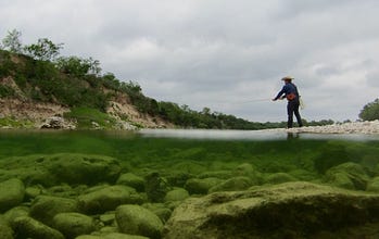

By Ben Christensen, Old Republic Journal
On a hot afternoon in late summer four years ago, I eased the huge, silver Ram heavy duty diesel pickup (the War Elephant) along one of those “private—no river access” roads. It’s a caliche road used by about a dozen people too many for the sign to be enforceable in reality, leading to my favorite parking spot under some overhanging Live Oak shade branches alongside the Pedernales River.
I was only so bold because, during previous fishing outings at the spot, the occasional stranger driving by invariably waved and smiled at me. Had I been wearing long rayon-polyester basketball shorts, a Jimmy Buffett Cheeseburgers in Paradise tank-top stained by blood-bait and gas station pizza sauce—rigging a leader with three treble hooks instead of assembling a Scott 4WT—I wouldn’t have been so fortunate. Sometimes even the fly rod doesn’t prevent that thing we all hate—the angry Nearby Neighbor slowing down and rolling down the window to ‘talk.’ But that’s another story for another day.
To my utter shock and dismay, a cursory drive over the concrete bridge revealed no water whatsoever. All that remained was sun-bleached algae clinging to darker dolomitic limestone rocks like a river’s farmer tan. I couldn’t help but study the dry bottom of the river I’d once scanned only through a nice layer of luminous, moving green water. I noticed the way the rocks sloped down in a serration, running uniformly to the southeast regardless of which direction the waterway turned. I was fascinated but horrified. Before this, I had assumed the Pedernales was spring-fed enough to be fishable in all conditions, at all reaches, all the time—the way the South Llano and the main stem of the Llano River have been so far.
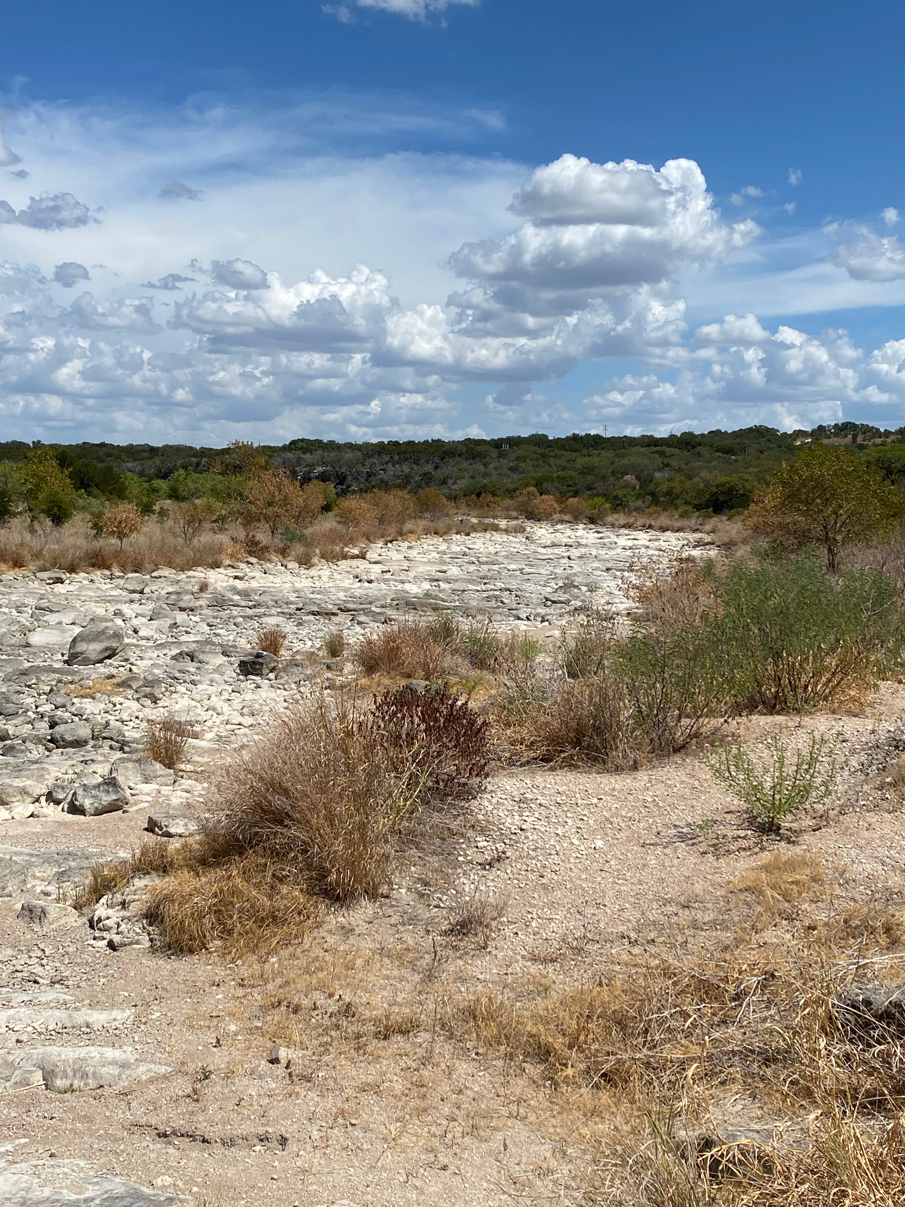
A faulted recharge reach of the Pedernales River, August 2022. Photo by Ben Christensen
I have enjoyed a little more than 13.5 years living in and fly fishing the Texas Hill Country. Congratulations to me: that translates to almost one entire drought/non-drought duration cycle.
This is more exciting for me than you might think. I am a weather nerd. I got that way by studying under Dr. Jim Norwine, professor emeritus at Texas A&M University, Kingsville, who has lent important contributions to understanding regional variability of El Nino in Texas. It’s no overstatement to say he is the lead figure-outer of how reversals in the cross-Pacific winds off the coast of Colombia, Ecuador, and Chile impact the dry-wet seesaw we call “hard times and good times” in Texas. Norwine and his peers in academia, of course, refer to it as the “El Niño-Southern Oscillation,” or ENSO.
Norwine is a classic professor type. As I remember, his clothes were shockingly wrinkled, even to my 17-year-old dorm-dwelling self. I recall something of an underbite, a mad academic wildness in his eyes, a lower lip that hung down when he spoke, and a habit drifting into somewhat extreme tangents. He tended frequently to murmur-laugh after his words tapered off, recalling something he thought was funny that only he seemed to be in on, like a crazy man. He was my first exposure to a True Academic, and I will always be exceedingly fond of the courses I took with him.

Dr. James Norwine, Texas A&M University, Kingsville. University Photo.
The man is sharp. With me at least, he had the unyielding talent necessary to keep an almost non-functioning hyperactive youth—to whom classroom boredom seemed to come rushing in immediately—completely engaged. I remember frantically taking notes for more than a full hour, developing my own college shorthand just to keep up with his meteorology lectures.
The following semester, in Norwine’s intro to climatology course, he had me carefully graphing out and projecting models of soil-moisture surplus and deficit using graph paper, a green map pencil, a red map pencil, and a big, slate-gray TI-84 calculator. For the first time in my life, I felt competent. I felt like I was understanding and computing deep scientific and mathematic processes, (even if they were actually quite basic).
But it was mostly long-form work, sort of like a 14-year dry-wet Texas precipitation cycle.
If you want to understand Texas climate fluctuations, you must understand El Niño/Southern Oscillations. Most basically, an El Niño weather event typically results in a much wetter, milder winter for Texas. If it isn’t rudely interrupted by the reversal of the pattern that scientists jokingly named “La Niña,” it will continue into a wetter summer pattern as well, resulting in above-average rainfall. Typically.
El Niño refers to the Christ child, whose birth (you may be aware) is celebrated on December 25, right around the winds these winds typically begin to slacken and reverse, spelling temporary disaster for South American Pacific fishing (my Ecuadorean father-in-law is one of them). As long as the trade winds blow westward, causing a rich upwelling of cold, nutrient-dense water to circulate from deep in the eastern Pacific, the fishing is good. That is a neutral year. An El Niño pattern undoes that: slackening the normal winds and sometimes reversing wind direction in the Southern Pacific, causing upwelling to cease.
A La Niña event, on the other hand, is a major boon for South American commercial fisheries, because it’s a forceful trade-wind pattern that makes that nutrient-rich upwelling even more intense. For Texas, the misfortune of South American fisheries usually translates to ample rainfall for agriculture, surface water collection, and us—fly anglers and our beautiful streams.
While it’s helpful to remember “El Niño wetter, La Niña dryer, neutral normal,” as a rule of thumb, there is massive variability. Like a Mandelbrot set—those old Chaos Theory fractal models—there are swirls within swirls, branches splitting, things spinning off to do their own thing, and variables ricocheting off other variables.
For instance, Norwine helped pioneer the idea that the way moisture is retained in the soil can influence, prolong, or truncate regional drought—a process known as soil moisture-precipitation feedback. That’s what he had us modeling with map pencils. That’s where you go deep down the research hole and things get dark, because manmade modifications to the landscape are generally deleterious to rainfall and groundwater retention, accelerating climatological degradation.
And that’s not even getting to the effects of the unfathomable amounts of carbon dioxide the Chinese have pumped into the atmosphere over the past couple of decades with their concrete clinker kilns for several behemoth dam projects.
I will talk about groundwater degradation and Texas Hill Country land development in a later article, but Dr. Norwine’s work taught us that what you do to the earth redounds into the clouds and rainfall patterns. I remember being struck by his introduction of the idea of urban “heat island” effect and how it alters regional weather. Again—for another day.
For now, I want to sit in silent optimism. Climate modelers are anticipating a very strong “super” El Niño for winter 2026-2027. The implications are nothing short of potential aquifer recharge and river replenishment. I have tolerated enough days of single-digit cubic-feet-per-second (CFS) discharges in the Pedernales River since late 2021; I could use some steady chuggin’ 20-something CFS at least. As it is, a good rain puts us up to around 8,000 CFS on the Pedernales, followed by a sharp drop back to single digits in about 9 weeks if no more noteworthy rainfall occurs. The curve down used to be a more gradual slope, but times have changed.
If you want a quick snapshot of the health of Texas Hill Country streams without navigating the U.S. Geological Survey’s dashboards, a good hack is to check the U.S. Drought Monitor Map. From there, look at the individual lake levels for Canyon Lake (Guadalupe River), Medina Lake (Medina River), and Lake Buchanan (pronounced ‘Buh-CANNON’—I know, it offends my ears too) for the Colorado River Basin, which includes the longest Texas-only river, the Colorado, as well as the Llano River.
As of July 7, 2026, the southeastern swath of my home turf in Blanco County in moderate drought, and my homestead above the Pedernales (no direct access, sorry) is categorized as ‘abnormally dry,’ even after some outstanding May and June rainfall. West of us in Gillespie County, there is no drought, and the same goes for Kimble and Kerr counties, where the Llano and Guadalupe play.
Canyon Lake is 61.1% full, which is a good, sound number for late July, especially when anticipating a super El Nino event and a wet winter ahead. Lake Medina is 9.0% full, the highest it’s been since late August 2022. Recent rainfall brought that notorious leaky, evaporative bad idea of a lake back up to its current level only about a month ago. Buchanan is sittin’ pretty at 99.3% full.
However, for the next edition of Fly Fishing the Texas Hill Country in the Middle of Damn Summer, we will look at how sharply these water bodies draw down from otherwise robust volumes.
And that mile-long stretch of dry riverbed on that day I got river-skunked? I’m a geology nerd too, so I knew it was a faulted recharge zone, with the water simply flowing underground somewhere. I climbed back into the War Elephant and headed upriver to McDougall’s Crossing near Stonewall and fished the slimy algal pools at the low-water crossing. I don’t remember the fish I caught, but I never get skunked on the Pedernales. It’s not braggin’ if it’s true. We’ll see ya out there. -Ben
Good story.